I've been scheming for a few years now on how to get in a long run in the White Mountains of New Hampshire. I've been living in or visiting the area for my whole life, but haven't had the opportunity to play in the Whites once I began trail running. I became focused for a year or so on the Presidential Traverse, but the point to point nature creates some logistical issues for a solo run. I entertained the idea (for a fraction of a second) of an out & back Presi Traverse, but that would be a LONG day and one I wouldn't feel comfortable doing alone.
A few months ago, I was reading about the Presi Traverse and heard about the Pemi Loop. A 31.5 mile loop, hitting nine summits, climbing 9,160', and encircling the Pemigewasset Wilderness area. You can add a couple more summits if you want, but the specs above are for the basic loop. It sounded awesome.
The book time for the Pemi Loop is 20hrs15min, but thanks to Adam Wilcox and his blog reports on his FKT attempts, running it can cut that in half or more.
The tough thing about living and trail running in Colorado is that I tend to underestimate runs at lower elevations. I'll make it very clear here (so I remember the next time I attempt anything in the Whites), running these trails is stinkin' tough. I should have remembered that from my Elwell Trail run in 2010. You really need to redefine what you call "runnable." And as you will soon see, the weather can become a major factor without any notice.
With a week of vacation visiting my folks on tap, this was my chance for a final long run before Leadville.
On Wednesday morning, I got myself to the Lincoln Woods Trailhead about an hour before sunrise. I donned my headlamp and started the counter-clockwise loop by getting the long, flatish stretch up the Wilderness Trail over with first. Man, were those woods dark! With such thick tree cover, I needed my light even after the sky lightened significantly.
Lincoln Wood Trail - a converted rail trail. Spooky indeed.
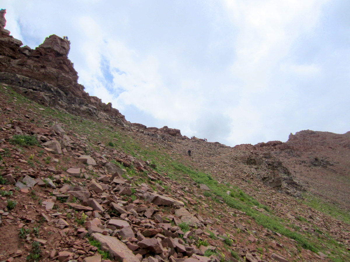
Heading up the Bondcliff Trail. Finally enough light to start snapping pics!
A "runnable" stretch of the Bondcliff Trail.
Can you guess what elevation I was at when coming across this sign? 4100'.
Here are a few shots from my approach to Bondcliff. As you will soon see, I don't have many pictures that capture the beauty of the Pemi Loop, so I need to show the ones I got early in the day.
Bondcliff with Mt. Bond in the distance.
Are these clouds an omninous sign? Or just passing by before the forecasted beautiful, clear day arrives?
Next up - my first summit of the day - Mt. Bond.
Looking back at Bondcliff and enjoying the most visibility I will have for hours & hours.
Summit #1 - Mt. Bond
I was bummed to summit Bond and find it in a cloud. Little did I know that would be the way it would roll for summits 1-7.
#2 - Mt. Guyot...or this might be #3 South Twin. At this point the summits were not enjoyable to hang out on.
I was still having fun out there, but I was ready for some sun and views. As mentioned before, the forecast had called for clear skies, so what did I miss?
I arrived at the Galehead Hut just after all the campers ate breakfast. The smell of coffee & pancakes wafted through the air. Drool started running down my chin. I quickly refilled my water and got the heck out of there despite the many weird looks I received from the "dressed for winter" hikers. Seemed that wearing shorts and a t-shirt was not the popular choice.
This is what I missed! A forecast specifically for the high summits. Definitely more "in" the clouds than "out". And what is that wind forecast I see?
The trails from the hut to Mt. Garfield were extra slick. The rocks were wet most of the day, but it was now that I noticed the trails were getting very steep. Somewhat of a treacherous combination. Of course my pictures don't quite capture that.
One word of caution when hiking/running in the Whites. Be prepared to use your hands...a lot.
Mt. Garfield summit. After the short video below, the camera went away as I went into survival mode.
This short clip captures about 25% of the cold & wind I would soon experience.
Some of my yummy grub for the day. I had made two packages of Ramen the night before. It was a nice salty treat after a few hours of running.
I ate the above noodles on my ascent of Mt. Lafayette. Just as I finished, three hikers were coming down the rocky trail. The last guy asked me if there were any more exposed sections between here and the Galehead Hut. I told him there was the brief stretch over Garfield, but otherwise he would be in the trees. There was an immense amount of relief on his face, so I had to ask "why?" He proceeded to tell me of the hours they had just spent on the Franconia Ridge Trail in what he described as 60-75 mph winds. My first reaction was to brush it off as an exaggeration. There was no way the 20-30 mph winds I had already experienced could be that bad on the ridge. Let's just say I won't ever take a claim that lightly again!
As I prepared to exit the trees, I noticed the intensity of the wind and clouds whipping by. I stopped and pulled all of my cold weather gear (a single 99 cent Walmart poncho) out of my pack. After stuffing the excess plastic down my shorts, I put my pack back on and plodded ahead. Upon entering the wind tunnel that was Mt. Lafayette, the sound of my poncho flapping in the wind was deafening and I couldn't walk a straight line. I was clinging on to the poncho (especially the hood squeezing it tight on my face) in fear that the wind might rip it off my body.
Time stood still during this stretch. I have no idea how long it took me to summit Lafayette. I do know that once I did, I made a bone-headed mistake and took the trail down to the Greenleaf Hut. I got about a third of a mile down before I remembered that I should have been on the ridge and not dropping straight down. If I had a REALLY low point of the run, this was it! Turning around I was staring at a steep climb of several hundred feet and in these conditions, my spirit was crushed. My core was staying warm, but my arms and hands were beet red and numb.
I re-summited Lafayette and began the trek to Mt. Lincoln. I don't remember hitting that summit at all. The wind was somewhat at my back, but the sustained power it had been unleashing on me was beginning to wear me down. Not to mention I was well over the 20 mile mark on very unforgiving terrain. Next came Little Haystack and I don't remember that summit either. With 20-40' visibility, I had no landmarks to judge where I was or how far I had gone. All I knew was that I was on the right trail thanks to some cairns and sporadic white spray paint marks.
Descending Little Haystack, I finally entered some trees and met some relief from the wind. A few moments later, I caught the first ray of sunshine. Ah, what bliss I felt. The poncho came off and I was a new man. Next thing I knew...there off the trail was a view into the valley below!
In the span of 20 minutes, the clouds lifted in dramatic fashion, the wind died down to tolerable levels, and I was soaking in the views I had been waiting all day to see!
Looking north to Garfield, Lafayette, Lincoln, and Little Haystack.
Franconia Notch
From Mt. Liberty looking south to Mt. Flume.
Looking north to Mt. Liberty from the final summit of the day - Mt. Flume
Had to prove it was me out there taking all of these pics.
The final descent down the Osseo Trail went without a hitch and I arrived back at my car 8hrs 54min after I left that morning. All things considered, I felt great and very satisfied completing one of the toughest 32 mile (a little extra thanks to my Greenleaf excursion) run I've ever done.
Later that night, I got enthralled reading about why the weather in the White Mountains is so harsh. Mt. Washington (6288') is the eastern neighbor to the Pemi Loop trails, and that peak has been declared as having the "worst weather in the world." While that claim is debatable, the following article is an interesting read - Worst Weather in the World.
In closing, the White Mountains may not have the high altitude found in Colorado, but they are every bit as beautiful and certainly more challenging. I can't recommend the Pemi Loop enough for those looking for an amazing day on trails. Just be sure to check the right forecast and be prepared for anything.
It's prime time for running in the high country and an attempt at the Four Pass Loop in Aspen was on tap this weekend. This classic and bucket list loop around the Maroon Bells consists of 27 miles, 8000' of climbing, and going up and over four 12,000+ passes. It's most commonly known for being a 3+ day backpacking trip, but for adventurous trail runners, the challenge is to try to run it in a day.
My watch died just below W. Maroon Pass, so I drew in the remaining route.
I ran the Buchanan-Pawnee Pass (only 2 passes) a few weeks ago and declared it to be the most beautiful run I've ever done. Well, that one has quickly been knocked down to #2 on that list. There just aren't enough words to describe what you see during the Four Pass Loop. My partners in crime were Patrick, Kieran, Scott, and Jaime. A few nice folks from Aspen/Carbondale also met up with us, but they were fast from the start and weren't seen again until we finished. Yes, we finished it! I arrived back at the parking lot with Jaime right at 7 hours and 9 minutes.
Almost ready for our 6:20am departure.
And we're off. There were about 15 photographers waiting for the sunrise on the lake's edge. They all turned around and stared trying to figure out why nine people would be running towards the Bells.
The smooth trail around the lake quickly turned into this.
Biggest climb of the day - heading up to Buckskin Pass.
PG running the only downhill stretch before the pass.
You're going to see A LOT of flower pictures. And none of them will do any justice to how vibrant they were.
The 14er neighbor to the Maroon Bells - Pyramid Peak.
From atop Buckskin Pass (12,462') . Looking north towards Snowmass Peak, Mtn, and Lake. Pass #2 - Trail Rider Pass sits just below Snowmass Peak.
Jaime bombing the downhill from Buckskin.
Scott rounding the corner with Snowmass Peak and Hagerman Peak right off his shoulder.
Snowmass Lake! The most beautiful mountain lake I've seen in Colorado.
During this stretch, there was no running while looking at the lake.
Snowmass Peak.
I think I came across every color of Indian Paintbrush.
Our last view of Snowmass Lake from Trail Rider Pass (12,420'). I can't wait to go back and camp there someday.
From atop Trail Rider Pass looking down the Lead King basin..
After a gnarly steep descent from Trail Rider (left center), Kieran's enjoying a stretch of smooth singletrack.
Shortly after this shot, we stopped to filter some water from a creek. All was well until a scene from a horror movie unfolded. It was death by horsefly bites. We were swarmed.
The only creek crossing where you couldn't avoid getting wet. Well, Patrick managed to get only half a shoe wet? How?
Not sure where Frigid Air Pass was. Had to go up and to the left of the mountain straight ahead.
An unnamed waterfall was impressive to stumble upon.
The trail continue to climb up to the right of the falls.
Entering the Fravert Basin.
Patrick is carrying a full bag of trash. Some backpackers dropped it in the middle of the trail. The only negative of the day - taking turns hauling trash for 12 miles!
Just a few flowers in the basin.
Look at this. Now look at the picture below.
The Fravert Basin. It's ALL wildflowers!
The backside of South Maroon Peak.
Frigid Air Pass (12,415') and our new, shirtless friend Rocky. If you get the chance, ask one of the runners about our encounter.
One more dip and climb to go. I mentioned to a few at this point that I would've been okay if this was only a three pass loop.
Where we came from and where we're going.
The flowers were still pretty, but our pace was not.
A close, but distant W. Maroon Pass.
A few hundred feet away from the "quadruple bypass."
From atop W Maroon Pass (12,500'). The home stretch straight ahead and to the left.
Trying to catch a sprinting Jaime. Somebody needed to remind him that he'd already run 23 miles! The last sunny shot before the rain and bb-sized hail started to fly.
Last looks at the Bells.
This run was satisfying on so many levels. It was fun to share the experience with some great people. I underestimated how difficult the drops and climbs would be, not to mention the challenge of spending most of the day above 11,000'. I'm sure I'll run it again someday. Hopefully before that day comes, I'll be back to do it slower - with a backpack. Running it was great, but hiking & camping it is now my desire. Guess I need to put that on another bucket list.
Post-run found us at Boogie's Diner in Aspen for a burger and beer. After inhaling our food, we all looked like we needed a nap. Instead, we faced the next endurance event - the three hour drive back to Denver.